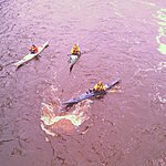
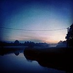
The national park, situated in Transitional Estonia, has been created to protect large raised bogs, flood plain grasslands, paludified forests and meandering rivers. The territory of the national park is mostly covered with large mires, separated from each other by the rivers of the Pärnu River basin — Navesti, Halliste, Raudna and Lemmjõgi rivers. Life in Soomaa depends more on climate than anywhere else in Estonia. When vast amounts of water run down the Sakala Upland, the rivers of Soomaa cannot contain it all. The flood has been called the "fifth season" in Soomaa. The water flows over flood plain grasslands and forests, and covers roads, disrupting connection with the outer world. In some years the spring floods have risen by a meter a day for 3–4 days. The Riisa flood area is formed in such a way; with a surface area covering 175 square kilometres at its largest it is one of the biggest natural flood area in Estonia. At the maximum flood level the water-covered area can be 7–8 km across. Steep-sloped, raised bogs stand as islands in the water.
The national park, situated in Transitional Estonia, has been created to protect large raised bogs, flood plain grasslands, paludified forests and meandering rivers. The territory of the national park is mostly covered with large mires, separated from each other by the rivers of the Pärnu River basin — Navesti, Halliste, Raudna and Lemmjõgi rivers. Life in Soomaa depends more on climate than anywhere else in Estonia. When vast amounts of water run down the Sakala Upland, the rivers of Soomaa cannot contain it all. The flood has been called the "fifth season" in Soomaa. The water flows over flood plain grasslands and forests, and covers roads, disrupting connection with the outer world. In some years the spring floods have risen by a meter a day for 3–4 days. The Riisa flood area is formed in such a way; with a surface area covering 175 square kilometres at its largest it is one of the biggest natural flood area in Estonia. At the maximum flood level the water-covered area can be 7–8 km across. Steep-sloped, raised bogs stand as islands in the water.

_large.jpg)
